


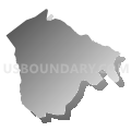
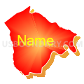
Garrett Precinct 13-001, Garrett County, Maryland
About
Outline

Summary
| Unique Area Identifier | 592401 |
| Name | Garrett Precinct 13-001 |
| County | Garrett County |
| State | Maryland |
| Area (square miles) | 18.08 |
| Land Area (square miles) | 17.87 |
| Water Area (square miles) | 0.20 |
| % of Land Area | 98.87 |
| % of Water Area | 1.13 |
| Latitude of the Internal Point | 39.40981890 |
| Longtitude of the Internal Point | -79.22444260 |
Maps


Graphs
Select a template below for downloading or customizing gragh for Garrett Precinct 13-001, Garrett County, Maryland


Neighbors
Neighoring Voting District (by Name) Neighboring Voting District on the Map
- Voting District 6, Mineral County, WV
- Voting District 8, Mineral County, WV
- Garrett Precinct 01-001, Garrett County, MD
- Garrett Precinct 10-001, Garrett County, MD
Top 10 Neighboring County Subdivision (by Population) Neighboring County Subdivision on the Map
- District 1, Mineral County, WV (9,275)
- District 10, Deer Park, Garrett County, MD (2,010)
- District 1, Swanton, Garrett County, MD (1,829)
- District 13, Kitzmiller, Garrett County, MD (716)